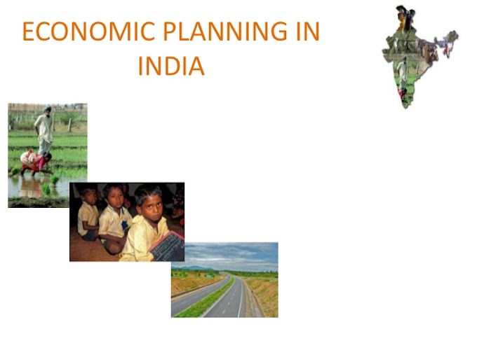
India’s road network is one of the largest in the world. The total length of roads is more than 33 lakh km.
For the purpose of maintenance and construction, roads are classified into National Highways, State Highways, District Highways, Village Roads, Border Roads, etc.
National highways are maintained by the Central Government, State highways by the respective state government while District highways by the respective District Board. Border roads and International highways are also die responsibility of Central Government.
The present length of the National Highways in India is approx. 45,000 km. They constitute only 2% of the total road length and carries nearly 40% of the road traffic.
Important National Highways
- NH 1: New Delhi – Ambala – Jalandhar – Amritsar.
- NH 2: Delhi – Mathura – Agara – Kanpur – Allahabad – Varanasi – Kolkata.
- NH 3: Agra – Gwalior – Nasik – Mumbai
- NH 4: Thane and Chennai via Pune and Belgaun.
- NH 5: Kolkata – Chennai
- NH 6: Kolkata – Dhule
- NH 7: Varanasi – Kanyakumari
- NH 8: Delhi – Mumbai (via Jaipur, Baroda and Ahmedabad)
- NH 9: Mumbai – Vijaywada
- NH 10: Delhi – Fazilka
- NH 11: Agra – Bikaner
- NH 12: Jabalpur – Jaipur
- NH 24: Delhi – Lucknow
- NH 27: Allahabad – Varanasi
- NH 28: Barauni – Lucknow
- NH 29: Gorakhpur – Varanasi
- NH 56: Lucknow – Varanasi
- NH – 7 is the longest highway of India.
Do you know?
- The Golden Quadrilateral Project connecting the four Metropolitan cities of Delhi, Mumbai, Chennai and Kolkata covering a total distance of 5846 km is currently being processed. It is the first phase of the National Highways Development Project (NHDP). Total cost of the project is Rs 300 billion, funded largely by the government’s special petroleum product tax revenues and government borrowing. As of June ’08, 5669 km of the intended road has been 4-laned.
- The North South – East West Corridor (NS-EW) is the largest ongoing expressway project in India. It is the second phase of the National Highways Development Project (NHDP), and consists of building 7300 kilometers of four/six lane expressways connecting Srinagar, Kanyakumari, Porbandar and Silchar.
- Maharashtra has the maximum length of surfaced roads in India.
Railways in India
- Indian railway system is the largest in Asia and the fourth largest in the world. It is the biggest departmental public undertaking in the country.
- The first train ran in India between Bombay and Thane, a stretch of 34 km. on April 16 1853.
- The Indian Railways celebrated its 150th anniversary on April 16, 2003. To commemorate the occasion, 16 January – Shatabadi inter – city express trains were announced to be inducted.
- The second train ran between Howrah and Hooghly in 1854.
- The headquarters of Indian Railway is in New Delhi.
- The first electric train in India was ‘Deccan Queen’. It was introduced in 1929 between Bombay and Poona.
- Indian Railways has the second biggest electrified system in the world after Russia.
- The fastest train in India is the Shatabadi Express whose maximum speed is 140 km/hr.
- The total route covered is approx 63,000 km.
- The total number of railway stations in India is 7,100.
- The longest railway platform in India is at Kharagpur (W.B.).
- Mumbai is the destination where maximum number of trains in India head for.
- The longest train route is of ‘Himsagar Express’ from Jammu Tavi to Kanyakumari. It covers a distance of 3,726 km and passes through ten states.
- The first Metro Rail was introduced in Kolkata (W.Bengal) on October 24, 1984. The two stations connected were Dumdum and Belgachhia.
The Indian Railways operate in three different gauges :
- Broad Gauge Railway (Distance between rails is 1.67 m).
- Metre Gauge Railways (Distance between rails is 1.00 m).
- Narrow Gauge Railways India (Distance between rails is 0.762 or 0.610 m).
The broad gauge accounts for nearly 50% route followed by metre gauge (43%) and the remaining by narrow gauge.
Railway Zones
Indian railways are divided into 16 zones, headed by a General Manager who is responsible to the Railway Board, for all matters.
| Railway Zones | Head Quarters |
| Central | Mumbai VT |
| Eastern | Kolkata |
| Northern | New Delhi |
| North Eastern | Gorakhpur |
| North-East Frontier | Maligaon-Guwahati |
| Southern | Chennai |
| South Central | Secunderabad |
| South Eastern | Kolkata |
| Western | Mumbai Churchgate |
| East Coast | Bhubaneshwar |
| East Central | Hajipur |
| North Central | Allahabad |
| North Western | Jaipur |
| South Western | Bangalore (Hubli) |
| West Central | Jabalpur |
| South-East Central | Bilaspur |
- Northern Railway (NR) is the largest railway zone having length of 10,995 km.
- North – East Frontier (NEF) is the smallest railway zone having just 3,860 km route length.
- Konkan Railways India : It is a project to shorten the distance between Maharashtra, Goa and Karnataka. The total route length is 786 km between Apta (Maharashtra) and Mangalore (Karnataka).
Railway Manufacturing Units :
- Chittaranjan Locomotive Works : Located in Chittaranjan (W.B) and manufactures electric engines.
- Diesel Locomotive Works : Located in Varanasi (U.P) and manufactures diesel engines.
- Integral Coach Factory in India : Located in Perambur (TN) and manufactures rail coaches.
- Wheel and Axle Plant : Locatedat Yalahaka (Bangalore, Karnataka) and manufactures wheels and axles.
- Diesel Component Works : Locatedat Patiala (Punjab) and manufactures components of diesel engines.
- Rail Coach Factory in India : Located at Kapurthala (Punjab) and manufactures rail coaches.
Air Transport in India
- J.R.D. Tata was the first person to make a solo flight from Mumbai to Karachi in 1931.
- In 1935, the ‘Tata Air Lines’ started its operation between Mumbai and Thiruvananthapuram and in 1937 between Mumbai and Delhi.
- In 1953, all the private Airline companies were nationalised and Indian Airlines and Air India came into existence.
- Air India administers international flights while Indian Airlines caters to the domestic circuit.
- Indian Airlines is now known by the name of ‘Indian’.
- Vayudoot Limited started in 1981 as a private air carrier and later on it merged with Indian Airlines.
- Pawan Hans Limited operates helicopter support services to oil sector, hill stations and remote areas.
- A number of private airlines also operates is India. They are Jet Airways, Sahara, etc.
- The Civil Aviation Centre in Fursatgarh near Allahabad provided, among other things, ground training to the pilots.
Airports in India :
There are 12 International Airports in India :
- Begumpet Airport, Hyderabad
- Calicut International Airport, Calicut
- Chatrapati Shivaji International Airport, Mumbai
- Chennai International Airport, Chennai
- HAL Airport, Bangalore
- Goa Airport in Vasco da Gama city, Goa
- Lokpriya Gopinath Bordolio International Airport, Guwahati
- Indira Gandhi International Airport, Delhi
- Netaji Subhash Chandra Bose International Airport, Kolkata
- Rja Sansi International Airport, Amritsar
- Sardar Vallabhbhai Patel International Airport, Ahmedabad
- Thiruvananathapuram International Airport, Thiruvananathapuram
The Indira Gandhi International Airport and the Chatrapati Shivaji International Airport handle more than half of the air traffic in South Asia. Besides these airports several other domestic airports are located in India.
In total, there are more than 334 civilian airports in India – 238 with paved runways and 108 with unpaved runways.
Water Transport in India
Most efficient, least costly and environment friendly means of transportation.
The total length of navigable waterways in Indian comprising rivers, canals, backwaters, etc, is 14,500 km out of which 3700 km is navigable by mechanised boats.
The government has recognised the following National Waterways of India:
- NW 1: Allahabad to Haldia – 1,629 km
- NW 2: Sadia to Dhubari (on Brahmaputra river) – 819 km
- NW 3: Kollam to Kottapuram – 186 km
- NW 4: Kakinada to Marakkanam (Along Godawari and Krishna river) – 1,100 km
Ports in India
- The Waterways Authority in India divides Indian ports into three categories, major, minor and intermediate.
- India has about 190 ports in all, with 12 major and the rest intermediate and minor.
Major Ports
The 12 Major Ports are:
| Port | State |
| Kolkata (including Haldia) | West Bengal |
| Paradip | Orissa |
| Vishakhapatnam | Andhra Pradesh |
| Chennai | Tamil Nadu |
| Ennore | Tamil Nadu |
| Tuticorin | Tamil Nadu |
| Cochin | Kerala |
| New Mangalore | Karnataka |
| Mormugao | Goa |
| Jawaharlal Nehru | Maharashtra |
| Mumbai | Maharashtra |
| Kandla | Gujarat |
Second classification
| SI. No. | Western Coast | Eastern Coast |
|---|---|---|
| 1 | Kandla (Child of Partition) | Kolkata - Haldia (Riverine Port) |
| 2 | Mumbai (busiest and Biggest) | Paradip (Exports Raw Iron into Japan) |
| 3 | Jawahar Lal Nehru (Fastest Growing) | Vishakhapatnam (Deepest Port) |
| 4 | Marmugao (Naval base also) | Chennai (Oldest and Artificial) |
| 5 | Mangalore (Exports Kudremukh Iron - ore) | Ennore (Most Modern in Private Hands) |
| 6 | Cochin (Natural Harbour) | Tuticorin (Southernmost) |
All these ports are administered by the respective Port Trusts, except the newly constructed Ennore port which is under the Ennore Port Ltd. Company.
Salient Features
-
Kolkata Port (including Haldia) : Kolkata is a riverine port, located about 128 km from the Bay of Bengal on the banks of river Hooghly. Haldia was developed because excessive silting prevented the entry of large marine vessels in Kolkata.
- Paradip Port : Located on the Orissa coast along the Bay of Bengal. India exports raw iron to Japan from here.
- Vishakhapatnam Port : The deepest port, located in Andhra Pradesh. It serves the Bhilai and Rourkela steel plants.
- Chennai Port : Oldest artificial harbour. This port ranks only second after Mumbai in terms of the traffic handling capacity.
- Ennore Port : Declared a major port in 2001. It is the first port with corporate participation. Provided with all the modern facilities for handling the thermal coal required for Tamil Nadu Electricity Board Power Station.
- Tuticorin Port : It came into existence during the reign of Pandya kings. It has an artificial deep sea harbour.
- Cochin Port : A fine natural harbour located on Kerala coast. Handles the export of tea, cofee and spices and import of petroleum and fertilisers.
- New Mangalore Port : The ‘Gateway of Karnataka’. Handles the export of iron-ore of Kudremukh.
- Marmugao Port : It has a naval base. India’s leading iron-ore port.
- Mumbai Port : A natural port, India’s busiest. A new port, Nhava Sheva, is being developed near Mumbai port.
- Jawaharlal Nehru Port : Occupies the 5th position in the world’s faster growing ports.
- Kandla Port : Called the ‘offspring of partition’ as it was developed after the partition as a substitute of Karachi port. It is a tidal port and a free trade zone located in the Rann of Kachchh.


